
 Chinese (Traditional)
 Chinese (Simplified)
 English



Shek Kip Mei Transport Guide for Tutors
TUTORZONE ROUTE GUIDE · KOWLOON DISTRICT
New to Shek Kip Mei and unsure how to get there? Understanding your transportation options ahead of time is the key to arriving on time. This article rounds up the most convenient MTR and bus routes, so you can reach Shek Kip Mei with ease from any district.
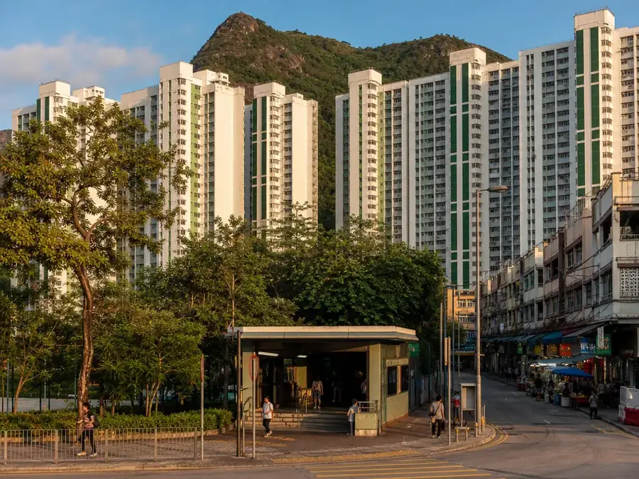
Shek Kip Mei at a Glance
Shek Kip Mei Station is located on the Kwun Tong Line and has convenient transportation access, making it suitable for instructors from all districts. The area is also served by a well-developed bus network that passes through many residential and commercial areas, offering a practical alternative to the MTR.
This article will provide you with the most convenient transportation options, including MTR and bus routes, to help you get to Shek Kip Mei with ease.
Getting to Shek Kip Mei
MTR
Shek Kip Mei Station is on the Kwun Tong Line. Recommended exits:
- Exit B1: Leads to Nam Shan Village, Shek Kip Mei Street and Berwick Street, suitable for going to the Community Education Centre.
- Exit C: Heads to Shek Kip Mei Park and Pak Tin Village.
MTR transfer suggestions:
- From Mong Kok/Yau Ma Tei: Take the Kwun Tong Line towards Tiu Keng Leng, which is 2 stops away.
- From Kwun Tong/Kowloon Bay: Take the Kwun Tong Line towards Whampoa, which takes about 20 minutes.
- From Hong Kong Island: Transfer to the Tsuen Wan Line at Admiralty, then transfer to the Kwun Tong Line at Mong Kok Station. It takes about 30 minutes to arrive.
Bus & Minibus
The franchised bus routes below all have a stop within roughly a 10-minute walk of this district — nearest stop and the areas they run through are checked against the current Citybus and KMB route and stop records:
- Citybus Route 702B — Pak Tin (North) ↔ Hoi Ying Estate
nearest stop: Mei Sang House Shek Kip Mei Estate, Woh Chai Street; runs through Shui Tin House Pak Tin Estate, Nam Cheong Street. - Citybus Route 702A — Hoi Ying Estate ↔ Pak Tin Estate
nearest stop: Mei Sang House Shek Kip Mei Estate, Woh Chai Street; runs through Shui Tin House Pak Tin Estate, Nam Cheong Street and Hong Tin House Pak Tin Estate, Pak Wan Street. - KMB Route 86C — LEE ON ↔ CHEUNG SHA WAN
nearest stop: Woh Chai Street; runs through Fu Tin House Pak Tin Estate, Shek Kip Mei Park and Shatin Hospital. - KMB Route 2F — TSZ WAN SHAN (NORTH) ↔ CHEUNG SHA WAN
nearest stop: Sham Shui Po Post Office; runs through Camp Street, Un Chau Shopping Centre and Cheung Lai Street Cheung Sha Wan. - KMB Route 2D — CHAK ON ESTATE ↔ WONG TAI SIN
nearest stop: Block 23 Shek Kip Mei Estate; runs through On Tin House Pak Tin Estate, Block 9, Pak Tin Estate and Fu Tin House Pak Tin Estate. - Citybus Route A23 — Tsz Wan Shan (North) ↔ Airport (via HZMB Hong Kong Port)
nearest stop: Pei Ho Street, Un Chau Street; runs through Kwai Chung Interchange, Kwai Chung Road. - KMB Route 86A — SHATIN WAI ↔ CHEUNG SHA WAN (KOM TSUN STREET)
nearest stop: Sham Shui Po Post Office; runs through Camp Street, Un Chau Shopping Centre and Cheung Lai Street Cheung Sha Wan. - Citybus Route 702 — Hoi Lai Estate / Nam Cheong Station ↔ Kowloon Tong (Festival Walk)
nearest stop: Mei Sang House Shek Kip Mei Estate, Woh Chai Street; runs through Shek Kip Mei Station, Woh Chai Street, Man Lok House Tai Hang Sai Estate, Woh Chai Street and Nam On House Nam Shan Estate, Tai Hang Tung Road.
Frequencies and fares change from time to time — check the Citybus or KMB app for live arrivals before you set off.
Shek Kip Mei Area Map
Here is the Google Map of Shek Kip Mei — click to explore the restaurants, malls and attractions in the area:
Citybus Information
For bus routes, frequencies and fares, check the official website:
- Citybus Official Website——www.citybus.com.hk.
Frequently Asked Questions (FAQ)
Q: Which MTR line serves Shek Kip Mei Station?
Shek Kip Mei Station is on the Kwun Tong Line. From Mong Kok/Yau Ma Tei it is 2 stops towards Tiu Keng Leng, from Kwun Tong/Kowloon Bay it takes about 20 minutes towards Whampoa, and from Hong Kong Island it takes about 30 minutes via transfers at Admiralty and Mong Kok.
Q: Which exits should I use?
Exit B1 leads to Nam Shan Village, Shek Kip Mei Street and Berwick Street, suitable for going to the Community Education Centre, while Exit C heads to Shek Kip Mei Park and Pak Tin Village.
Q: What bus and minibus routes serve Shek Kip Mei?
Citybus Route 103 runs from Pokfield Road to Po Kong Village Road via Shek Kip Mei Road, Citybus Route 12A runs from Admiralty (Tamar Street) to MacDonnell Road, and Green Minibus Route 32M runs from Mei Foo to Shek Kip Mei Station.
Q: How can I check the latest travel time before departure?
It is recommended to use Google Maps or the Bus Arrival App to check the latest travel time and route map before departure.
Further Resources & Next Steps
- Official Resource——Citybus: www.citybus.com.hk, for routes, frequencies and fares.
- Route Planning——Google Maps: search “Shek Kip Mei” to plan your journey in real time.
- Parent Tip——With the well-developed bus network threading through residential and commercial areas, checking the Bus Arrival App just before you leave gives you a reliable backup to the MTR.
Act Now: Find a Tutor / Register as a Tutor
For parents & students: looking for a home or online tutor in this district? Click the button below to post a free tuition case (subject, level and preferred time) — TutorZone will match you with suitable tutors:
For tutors: want steady lessons in this district? Click the button below to register for free — choose the districts and subjects that suit you, and pay only when a match is made:
Disclaimer: The information above is for reference only. Routes, frequencies and fares are subject to change; please refer to the latest announcements by Citybus and the Transport Department.
📌 This information was initially drafted and organised with AI. Editor-in-charge: Qian Jiajun